

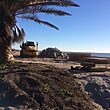
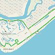


A tropical storm watch is in effect for Edisto Beach and the surrounding area as Hurricane Sandy passes by the region.
According to the National Weather Service, there is a possibility for storm-force wind gusts, which could be as strong as 40 mph and bring down electrical wires or tree limbs. There could be areas of flooding due to the storm surge, so be cautious while driving in low-lying tidal areas.
The high surf generated by this storm is expected to last throughout the weekend and could create breaking waves four to six feet high. Rip currents and long shore currents created by the storm will make swimming conditions dangerous and it is not advised that anyone get in the water.
Small watercraft should also stay docked until the storm passes.
After the storm moves away from the region, the rest of the week looks to be mild and sunny.
The high Monday is 65 with bright sunny skies. The low will be 44 degrees.
Wind and clouds move in on Tuesday, which should be right around 60 degrees with a low of 47 degrees. The clouds should dissipate some by Wednesday and the temperature will warm slightly to 66 degrees with a low of 48 degrees.
The rest of the week looks to be warm and sunny with highs right around 70 degrees and lows in the 50s. The warmer weather and sunny skies should last into the weekend as well.